Over the past 22 years UTAS has played a vital role in maintaining and improving the geographic coordinate system for the Australian continent. Through regular observations using Very Long Baseline Interferometry (VLBI), the precise location of the 26m telescope with respect to other telescopes world-wide has been measured and monitored to centimetre precision or one part in a billion. The Australian continental plate is the fastest moving plate on Earth, moving north-northeast at a rate of 5.779 cm per year and colliding with the Pacific and Eurasian Plates to the north.

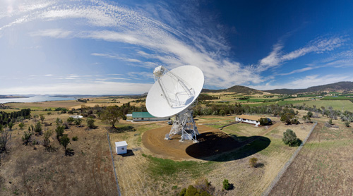
Mt Pleasant 26m antenna has been a workhorse of VLBI geodesy for over two decades (photo: Jim Lovell)
As well as providing important scientific information on the rotation of the Earth, the movement of continental plates and the effects of earthquakes, these VLBI measurements provide the fundamental reference frame for all other types of geographic positioning techniques such as GPS. Mt Pleasant Observatory provides the fundamental position reference point for all of Tasmania.
AuScope is funded through the Federal Government’s National Collaborative Research Infrastructure Strategy (NCRIS) and has established the facilities to study in unprecedented detail the structure and evolution of the Australian continent. The AuScope VLBI project comprises the construction and operation of three new radio telescopes by UTAS School of Maths and Physics and the establishment of a data correlation facility by the Curtin University of Technology.

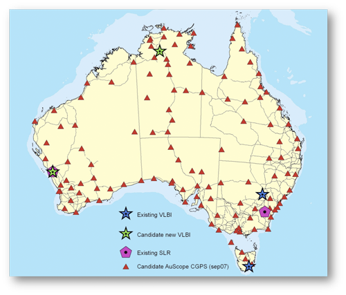
AuScope includes a new network of three radio telescopes and ~100 new GPS receivers
AuScope aims to provide a fundamental reference frame in Australia to 1 mm accuracy based on the locations of three radio telescopes as established by VLBI observations. One telescope is located in Tasmania, another in Western Australia at Yarragadee and a third in the Northern Territory at Katherine. Each site will hosts a permanent GPS receiver to tie the telescope reference frame to the denser GPS frame. This new facility will provide an integrated spatial positioning system spanning the whole continent, enabling:
- mm-accurate positions for real-time vehicle and aircraft positioning and navigation
- techniques to better identify and study regions of seismic risk, especially those associated with populated areas and mining
- precise measurement of variations in sea level
All three radio telescopes are now installed and operational.